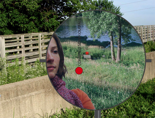
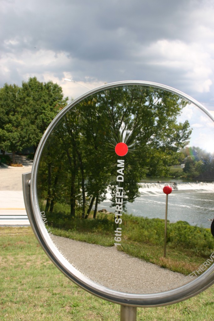
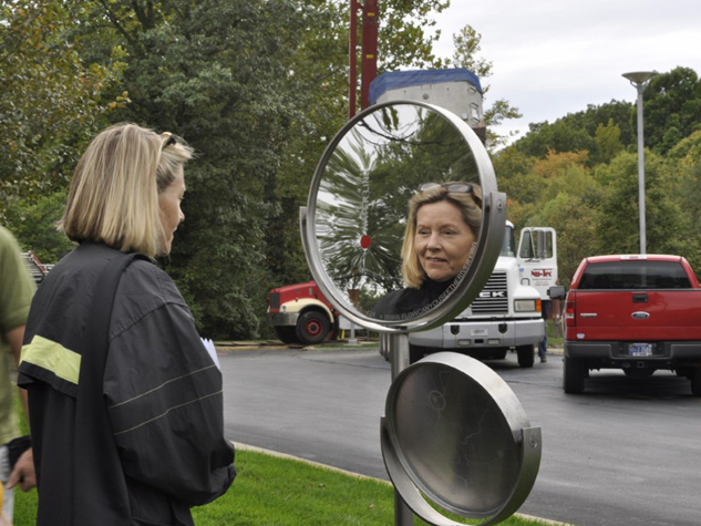
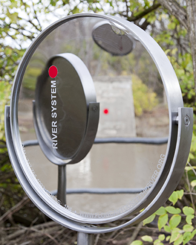
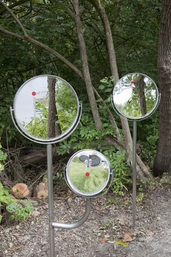
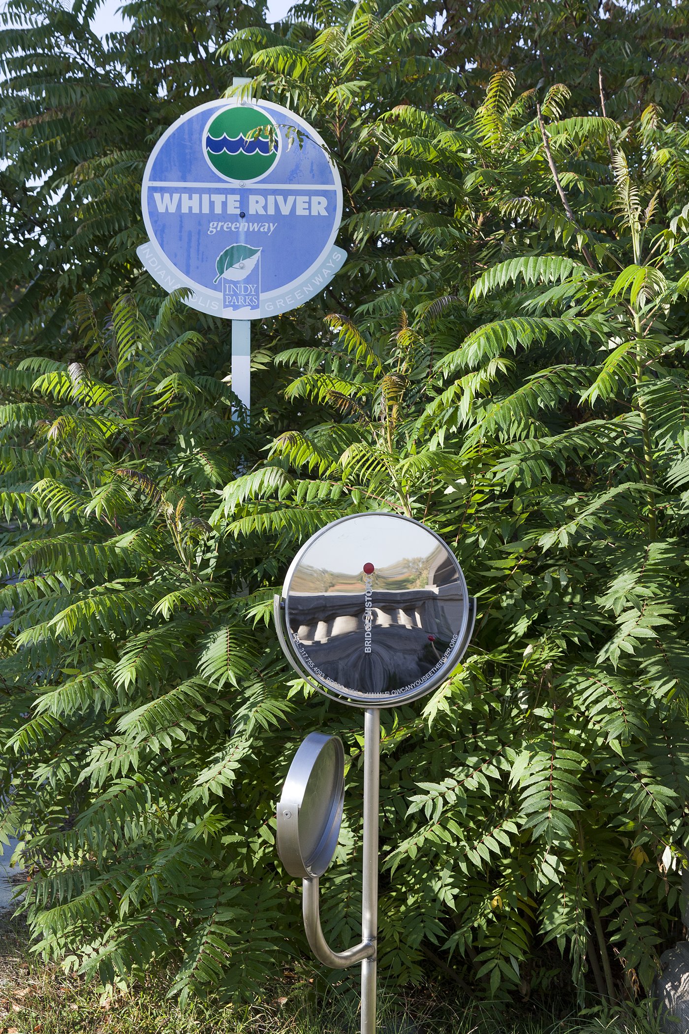
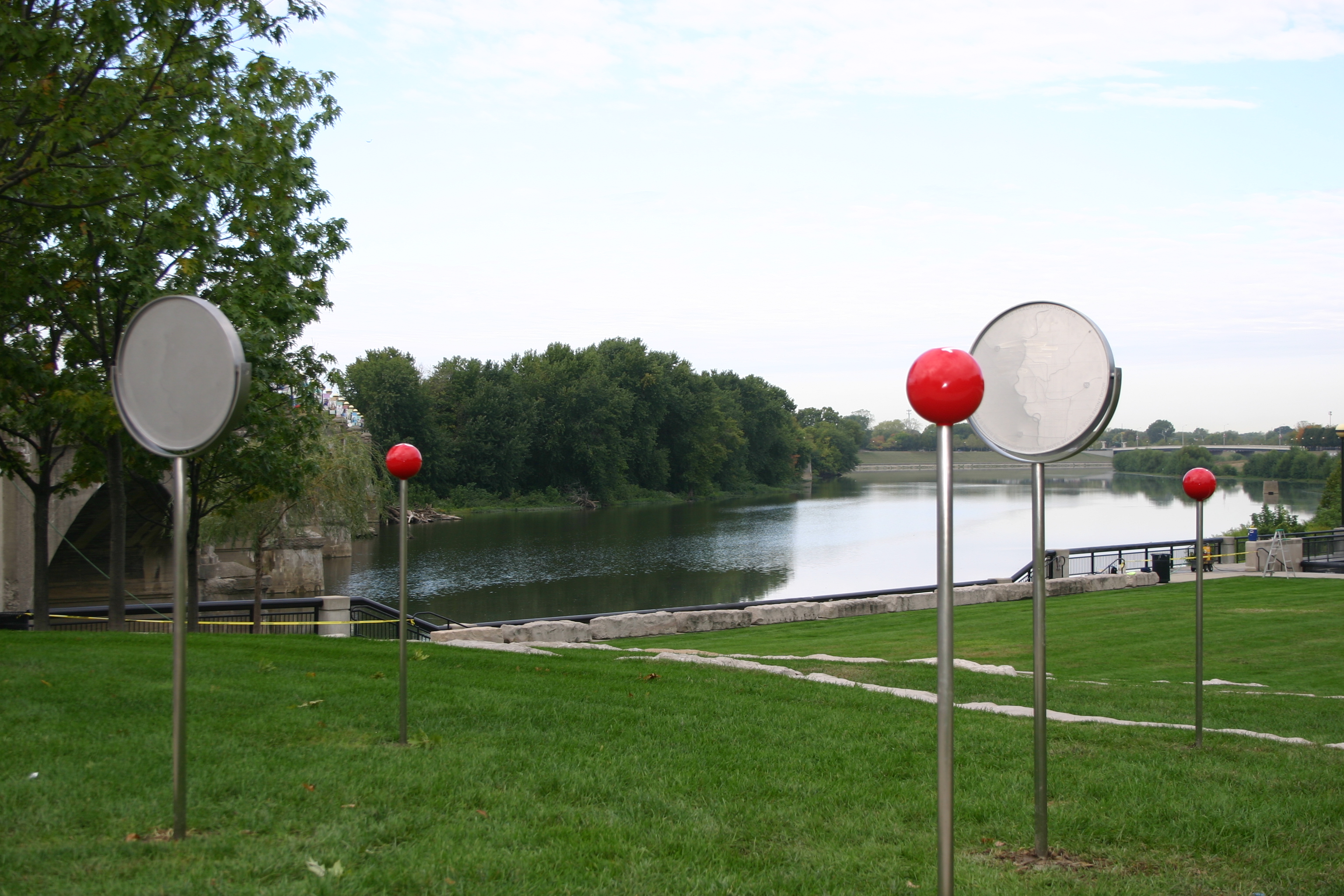
Collaboration with scientists and multiple institutions has informed a project made up of a series of ‘stopping places’ along a six mile stretch of the White River between the IMA and the center of Indianapolis. The project brings together the cognitive power of science with the effective power of art to raise river awareness.
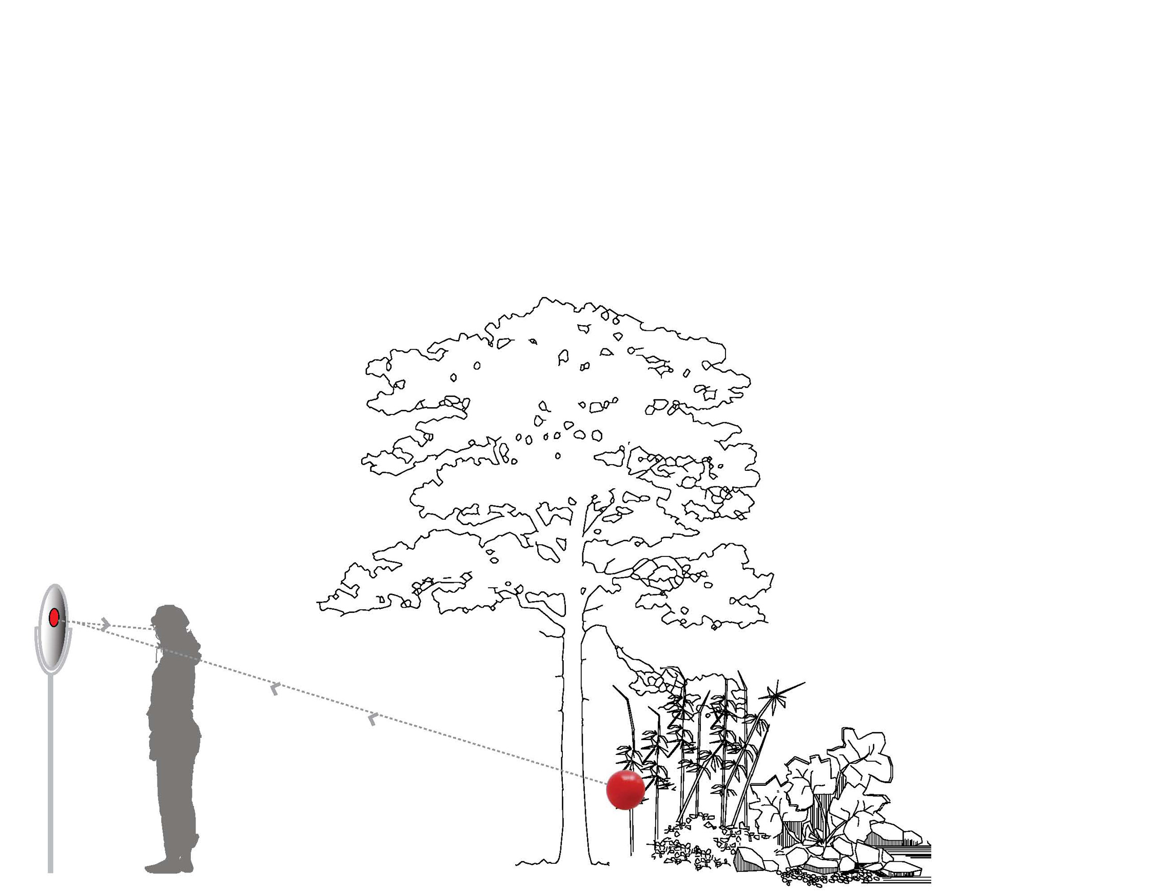
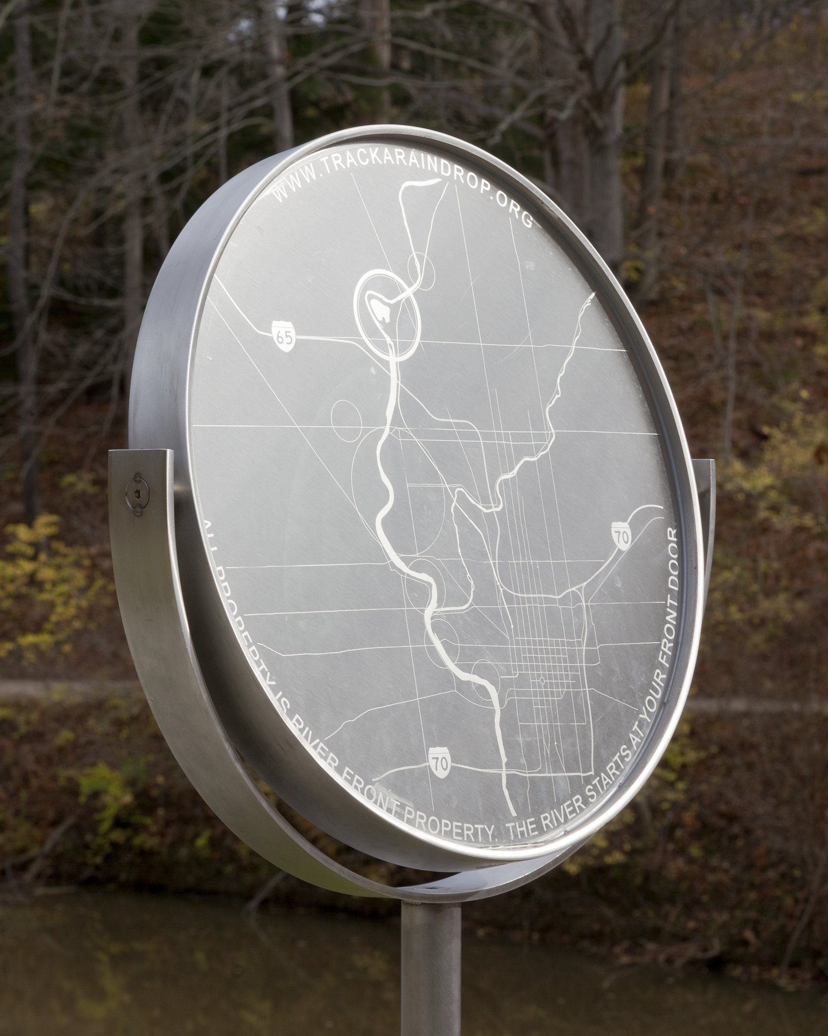
At each point along the river the visitor’s attention is drawn to a different aspect of the landscape. Physical and technological tools are developed to engage viewers and participators in different ways. Sculptural and informative are incorporated into the landscape itself, while new uses of technology – webcam projections, a Raindrop app and the development of Aqua-cache sites, allow a larger audience to understand more about the hydrological cycle.
This is the first City as Living Laboratory precedent project.
PROJECT PARTNERS: Indianapolis Museum of Art, United States Geological Survey, Indiana University Purdue University Center for Earth and Environmental Sciences, Indianapolis Mapping and Geographic Infrastructure System, City of Indianapolis, Marian University, The Indianapolis Project School, Upper White River Watershed Alliance, Eiteljorg Museum of American Indians and Western Art, National Weather Service Weather Forecast Office Indianapolis