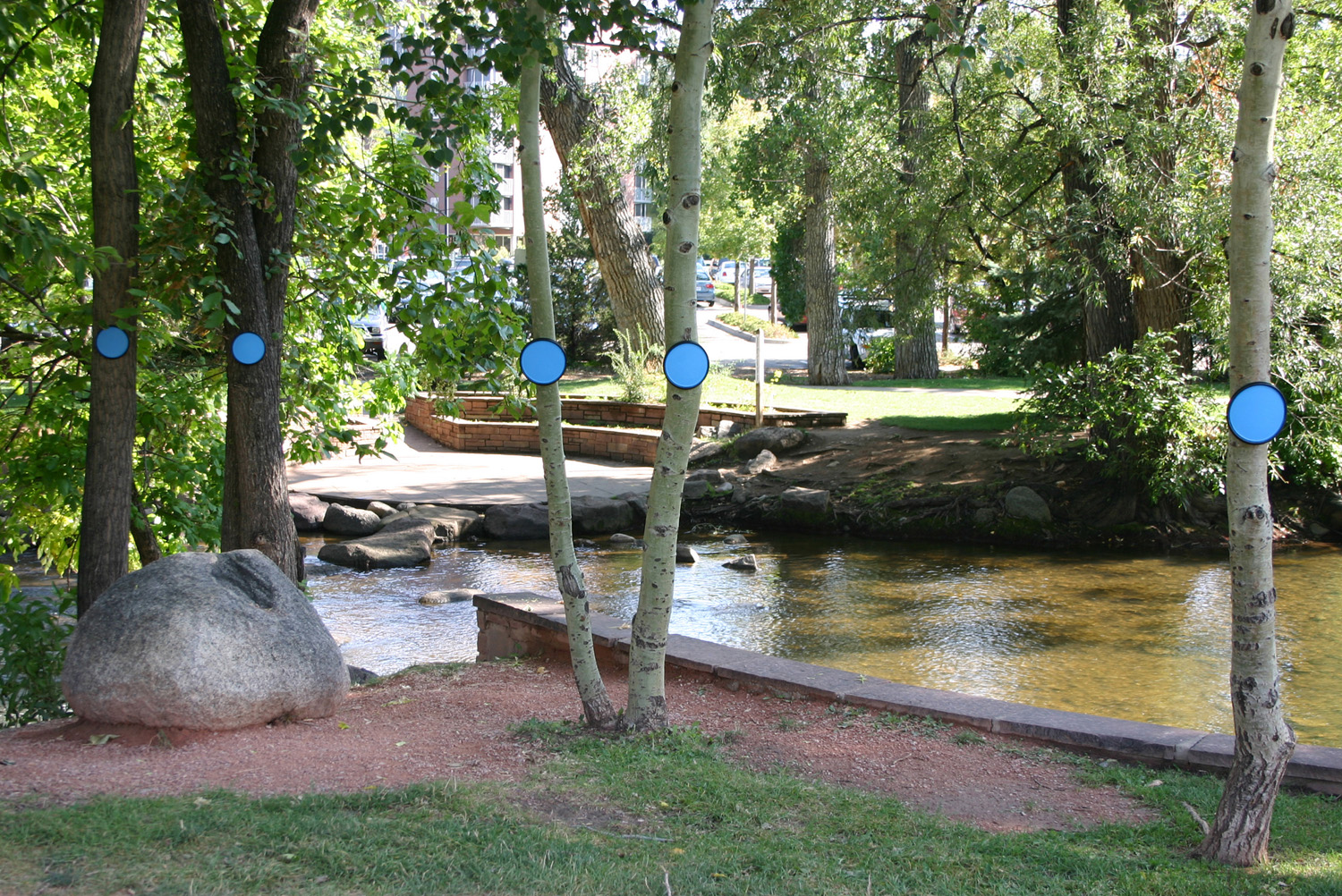
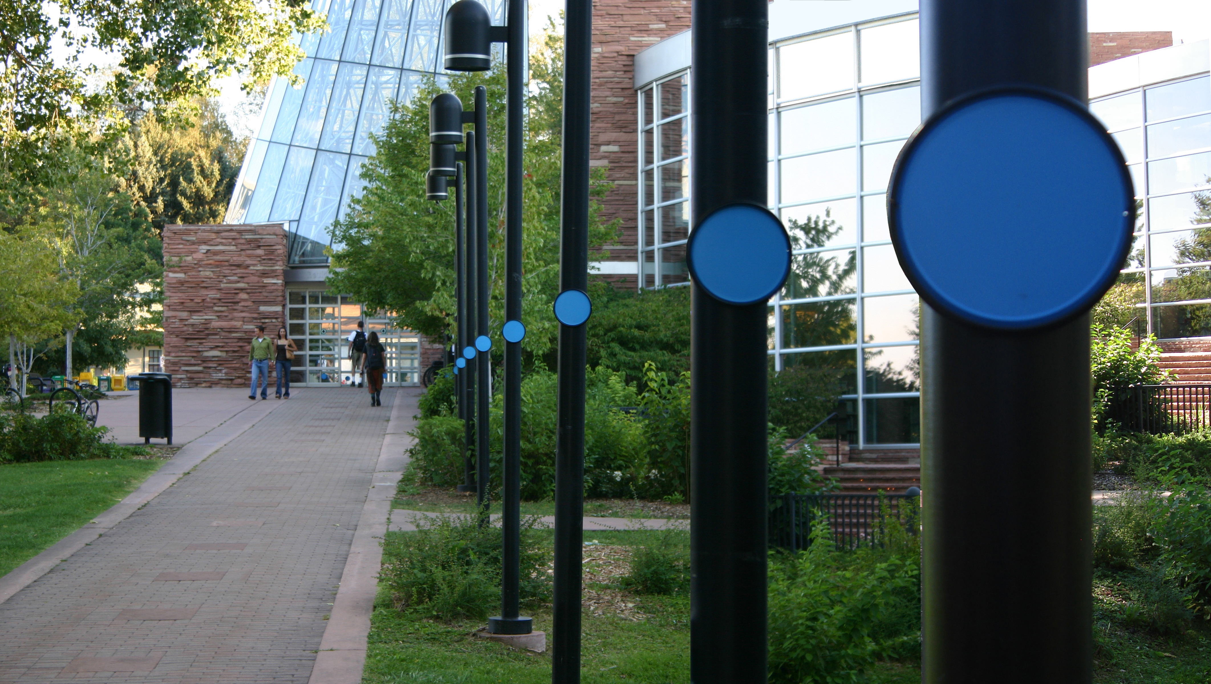

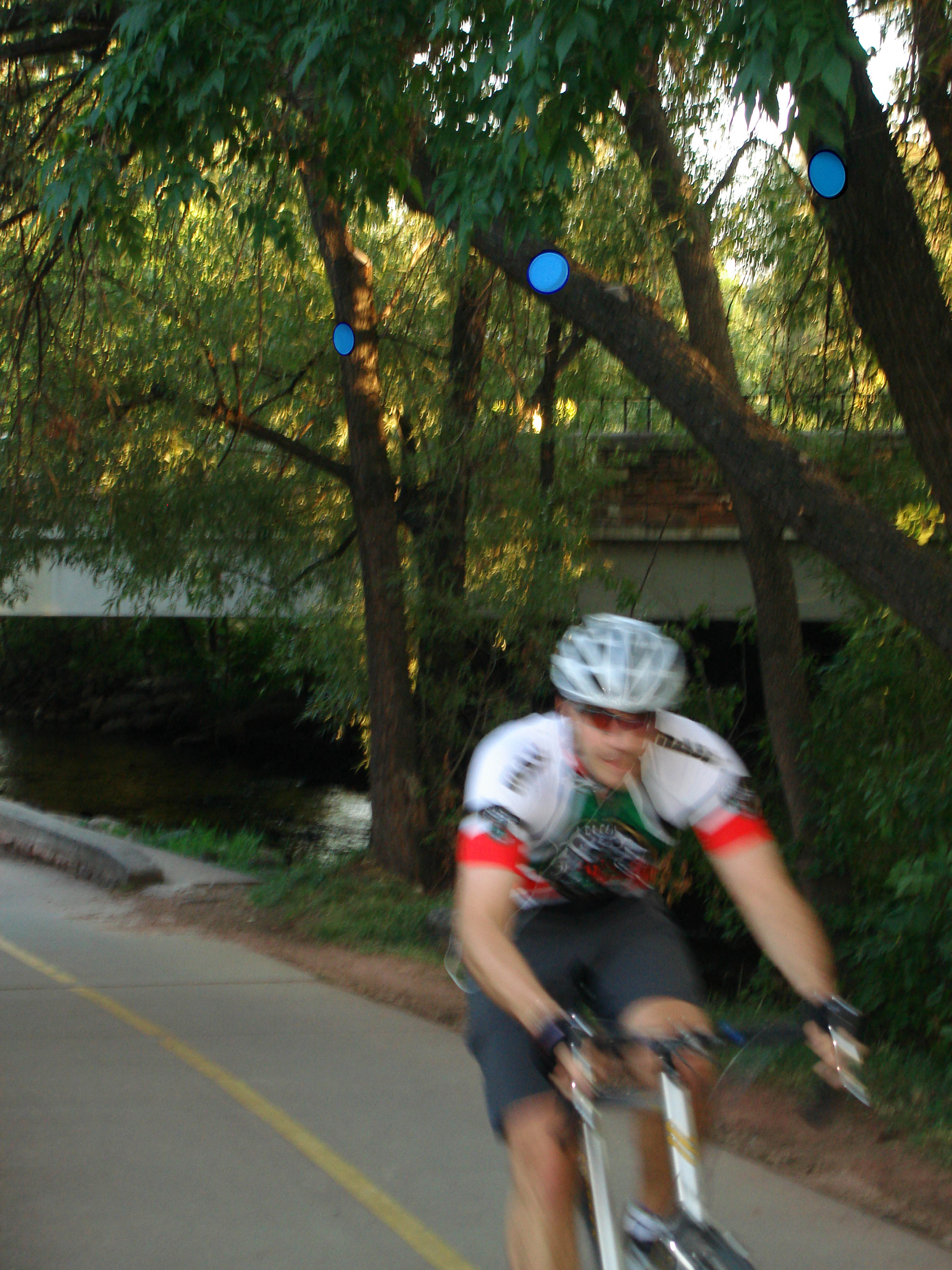
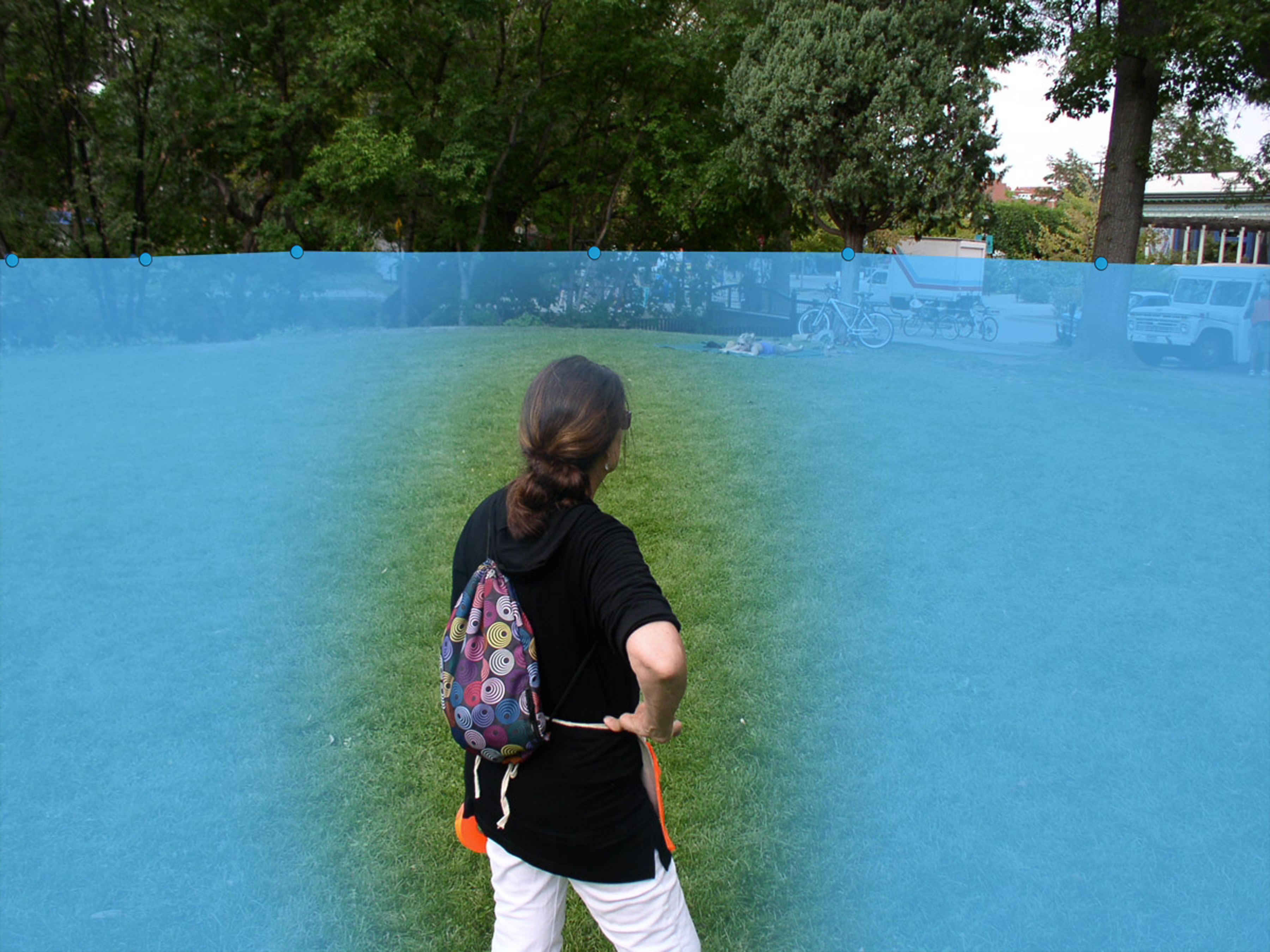
The process of focusing on an ephemeral event outside memory or experience produces an alternative kind of map of the city. Rather than claiming property or territory, it uses the infrastructure of the city–its bridges, stairs, streets and buildings–to create a three dimensional map which makes apparent the ever changing presence of water. Instead of an abstraction, it is a mapping that makes apparent the constancy of change.
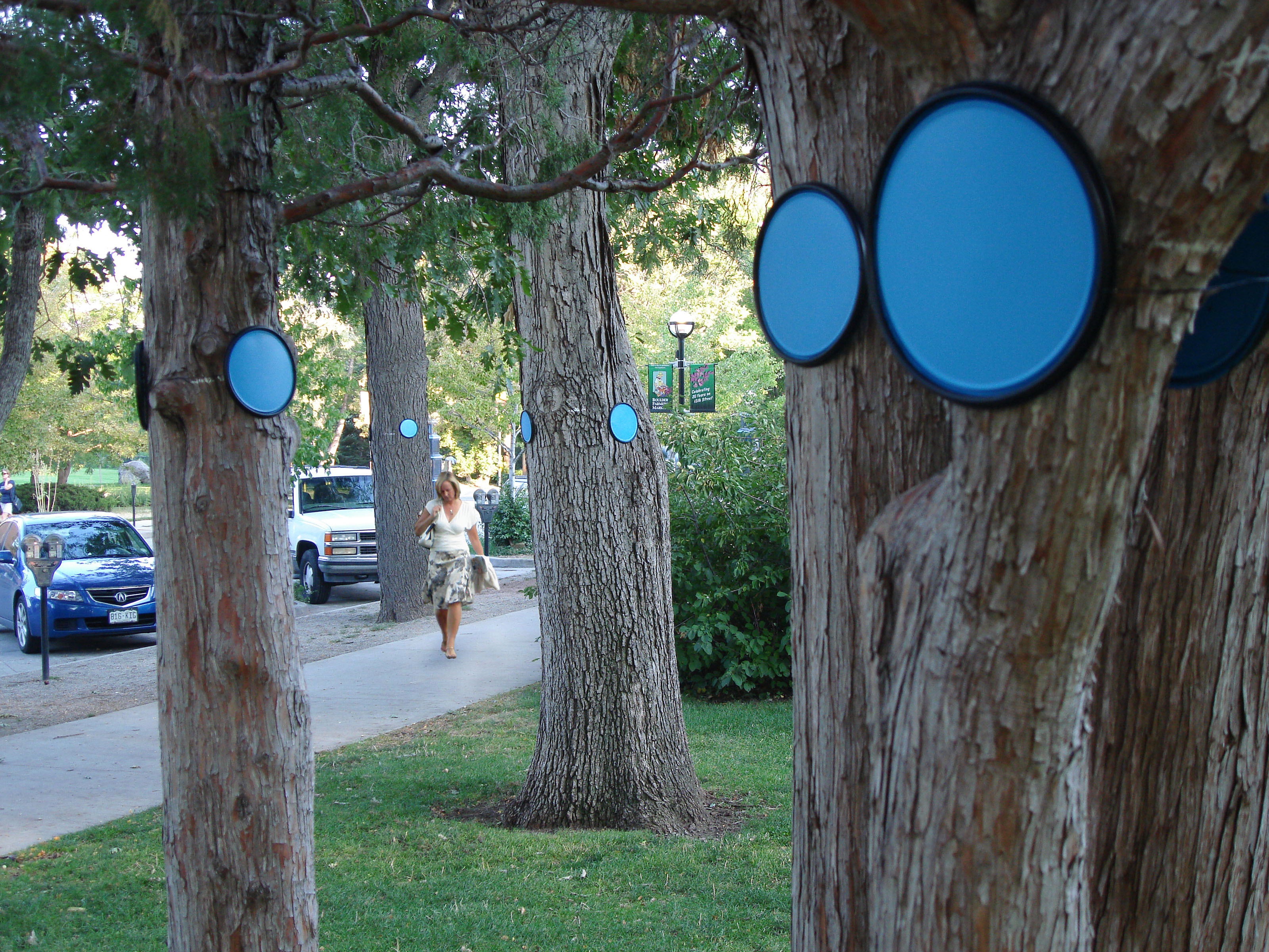
In the spring of 1894, a 100 year flood event occurred in downtown Boulder. Flash floods in Boulder Creek caused widespread damage as the city was inundated. Smaller floods have occurred in 1914, 1919, 1921, 1938 and 1969. The 100 year flood is used by FEMA to regulate flood plain management. Many experts believe it would be prudent for communities to be prepared for a 500 year flood event. A 100 year flood has 1% chance of occurring in any given year, a 500 year flood has a .2% chance of occurring. It is possible for two or more such events to occur in a single year. New weather patterns make the forecasting of such events less predictable: Hurricane Katrina had a .25% chance of occurring. The city of Boulder is located at the mouth of Boulder Can-yon. Because of its location, the nature of the steep slopes and long approach upstream the city is highly susceptible to flooding. The city is considered to be a high hazard zone where the question is not if there will be a flood but when will it happen.
This project is intended to bring attention to the possible flooding of Boulder Creek. It suggests some of the issues to be considered and how this information might be revealed. A fully implemented project would deal with these points and others in detail; it would be an ongoing collection of information involving experts in the field as well as the observations of the residents of Boulder.
You can learn more about the project in the booklet found here